I I get a lot of diff on open source code and graphhopper map.
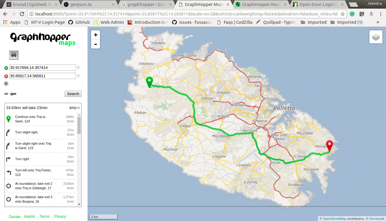
This is local host map for car.
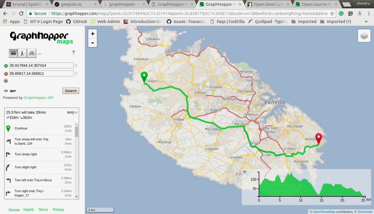
This is from graphhopper map for car.
Actually, I am using speed region from http://geojson.io/#map=12/35.8907/14.4506
Another static also here.
https://graphhopper.com/maps/?point=35.917694%2C14.357414&point=35.85817%2C14.565811&locale=en-GB&vehicle=car&weighting=fastest&elevation=true&use_miles=false&layer=Omniscale
@karussell Please, can you guide why are different path and different distance?
Why is what? The differences in the route? (please be more descriptive and actually ask a question  !)
!)
If so, then probably because of our improved ETAs and also see the differences between open source vs. our GraphHopper Directions API in the table below here.
hi, i faced this too.
I updated source code and map pbf file today but GraphHopper Directions API ETA is different from open source one yet . what would cause this ? and which one is more accurate ?


 !)
!)