Hi everyone,
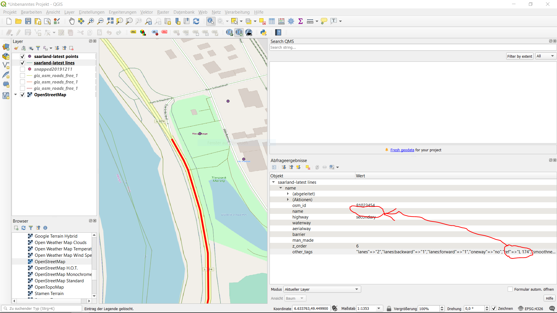
first of all thank you for providing this engine. Also I´m really new in handling geographic data and therefore I appreciate any kind of help or ideas. My question is related to the results I get from the graphhopper map matching api. I configured the API using the saarland-latest.osm.pbf (https://download.geofabrik.de/europe/germany/saarland-latest.osm.pbf) openstreetmap. Most of the coordinates are assigned to the right street names, this is especially true for the smaller streets in villages or cities. Nevertheless, the assignment for larger streets often is wrong. The street names of those larger streets are getting assigned to the names of the latest correct assigned smaller streets. The problem is that in germany sometimes larger streets like highways do rather have street numbers than street names. And this is exactly where the problem comes from. I opened the openstreetmap layer in QGIS and saw that indeed for larger streets like highways the “name” tag is empty. Therefore I think this tag is used by the api to do the matching and street name assignment. I think graphhopper tries to work around by filling the missing “name” values by the latest available “name” information.
But in fact whenever the “name” tag is empty in “other_tags” there is a subtag called “ref” containing a street number (the actual right name). To make it more clear I attached an image. Now my question would be if it is possible to hint graphhopper the “ref” tag so that it will match against this whenever the “name” tag is missing or if it is possible to store both information in the returned gpx-file?
Thank you in advance for your help!
Best regards,
Martin