Hello,
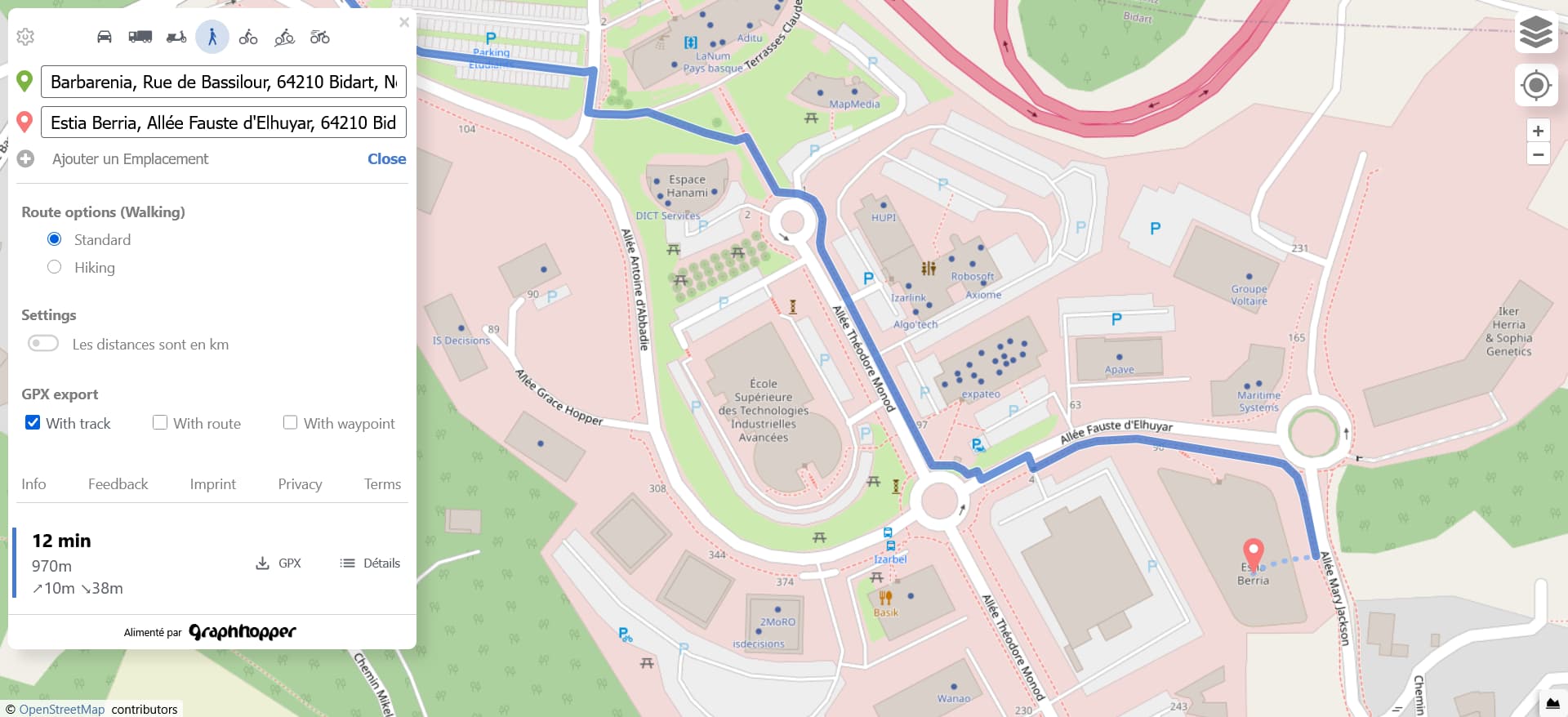
When I request a pedestrian route from a bus stop to the Estia Berria building , why does GraphHopper give a route that does not take the building entrance , even though it is mapped in OSM?
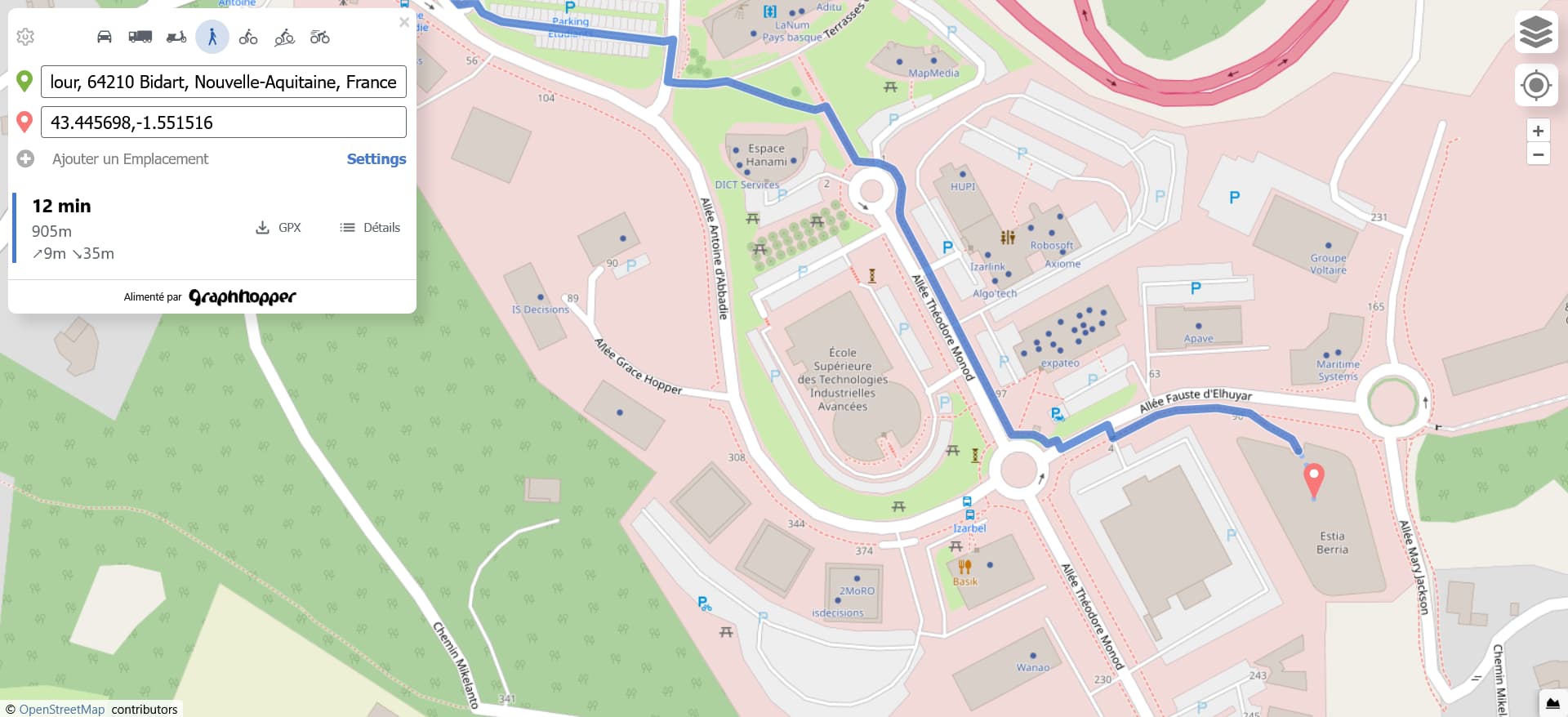
Obviously, when the arrival point is further north of the building, the pedestrian route is correct .
The problem is that the name of the building is indicated south of the shape.
Thank you in advance for your help, and sorry if this question has already been asked. My English isn’t very good.
The problem is that geocoders like photon (which we use for autocomplete) do not have this information in the database. But from a recent discussions with the dev from photon this will be included at some point in the future. And once it is there we can use it in GraphHopper Maps (if it is available in the data) and forward it to the routing engine.
1 Like
Thanks for your reply. Glad to hear that an improvement is planned. All we can do now is wait patiently.
otbutz
September 3, 2025, 2:01pm
4
The next Nominatim release will add support for entrances:
master ← emlove:return-entrance-location
opened 07:13PM - 05 Aug 25 UTC
## Description
This PR adds logic to record the main entrance location for plac… es. I'd love to get some feedback on the approach from maintainers on the approach here.
In this implementation a new `place_entrance` table, where entrance node details are stored.
Fixes #536
Example output:
```json
[
{
"place_id": 534548,
"licence": "Data © OpenStreetMap contributors, ODbL 1.0. http://osm.org/copyright",
"osm_type": "way",
"osm_id": 108240964,
"lat": "41.8838293",
"lon": "-87.6319547",
"category": "amenity",
"type": "townhall",
"place_rank": 30,
"importance": 9.99999999995449e-06,
"addresstype": "amenity",
"name": "Chicago City Hall",
"display_name": "Chicago City Hall, 121, Pedway, Loop, Chicago, Cook County, 60602, United States",
"entrances": [
{
"lat": 41.883881,
"lon": -87.6322362,
"type": "yes",
"osm_node_id": 2391052802
},
{
"lat": 41.8843544,
"lon": -87.6317131,
"type": "yes",
"osm_node_id": 2391052808
},
{
"lat": 41.8836391,
"lon": -87.632232,
"type": "yes",
"osm_node_id": 2391057836
},
{
"lat": 41.8833509,
"lon": -87.6317131,
"type": "yes",
"osm_node_id": 10922694346
}
],
"boundingbox": [
"41.8833431",
"41.8843544",
"-87.6322445",
"-87.6316693"
]
}
]
```
#### TODO:
- [x] Make entrances data opt-in
- [x] Implement other format outputs
- [x] Migration
- [x] Tests
As photon is importing its data from Nominatim, they’ll add support sooner or later
1 Like
system
December 2, 2025, 2:01pm
5
This topic was automatically closed 90 days after the last reply. New replies are no longer allowed.