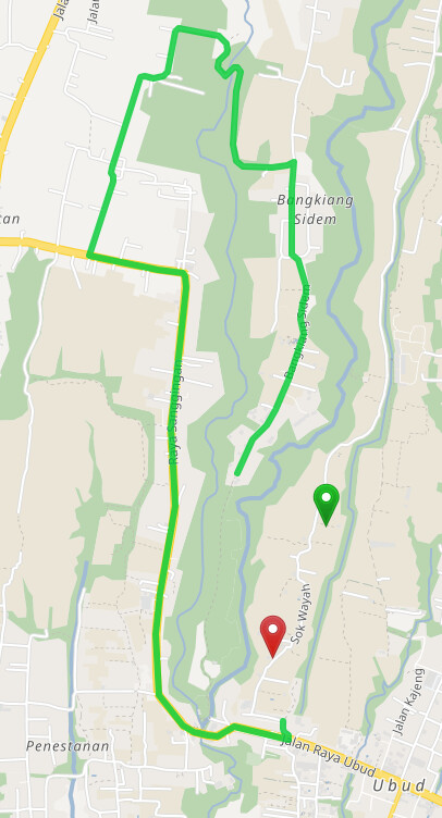
I encounter this strange route whenever I choose Car, Scooter, Small Truck and Truck as the vehicle type. The route polyline seems unable to generate into where the destination point is located. My initial thinking is there is an OSM tags that prevent any “motor” vehicle to pass through it.
This is the OSM ID where the destination point is located.
Based on the local knowledge by someone who resides there, the road is accessible by motorcycle, however it’s quite small for a car.
How I can solve this? Do I need to make OSM editing?
It looks like the Sok Wayah road is disconnected from the rest of the network, so it is not included. This is probably not only because of the narrow section but also for some other reason (probably another mapping error)
Thank you @easbar - I’ll try to look deeper on the OSM editing and road geometry for that particular OSM ID.
Just curious is there any docs or code configs in Graphhopper that I can take look which describe what are the tags that will influence each of the vehicle type?
The reason GraphHopper does not return a route for neither car nor motorcycle is the width tag though. Even for width=2 scooters are not allowed, but this should probably be fixed. If the road was wider the southern part would be accessible for scooters and cars, but the northern part would still only be accessible for scooters, because of the motorcar: no tag.