I understand there are differences in Walking vs Hiking modes, but this route is very surprising nonetheless:
https://graphhopper.com/maps/?point=28.353857%2C84.892049&point=28.355061%2C84.891948&locale=en-us&vehicle=foot&weighting=fastest&elevation=true&turn_costs=false&use_miles=false&layer=Omniscale
Try switching to Hiking mode or moving the lower route point just a bit further to the north to see the expected route.
Is this an OSM data issue or what exactly is causing GH to suggest that I should walk 247km(!) instead of the obvious hundred meter way?
Check the OSM mapping data at openstreetmap.org. If you go into edit mode with an account you can see a lot of detail/path configuration settings. See what might be causing it and try to eliminate/identify a potential easy explanation for the issue
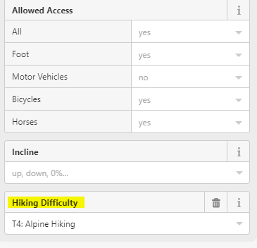
The hiking difficulty seems to restrict access for walking for that specific portion