Hi, Using version 7, I was having strange routes, so I tried version 8. But I still have weird routes. For example: the route here with all the default settings…
Looks like many others also have this problem (e.g., Strange routes at the border of dataset - #7 by Geoman, Strange routing - indirect route and more). What are the reasons that could be behind the weird routes? Sometimes, OSM tags show one-way which restrict direct route. What are the other possible reasons for these routes? How can we explain such routes? And how to solve/avoid these- any generic solution?
@karussell it would be nice if the snapping would be a bit smarter in that regard.
Instead of simply blocking trunk/motorway like we do it in the SnapPreventionEdgeFilter we could apply a factor to the normDist depending on the EdgeIteratorState.
e.g 2 * normedDist for trunk/motorway
Snap findClosest(double lat, double lon, EdgeFilter edgeFilter, EdgePriority edgePriority);
At the moment I don’t think a “smart” snapping would be an improvement. We have point_hints and snap_preventions for the /route endpoint, which should solve mostly all issues in this regard. For the public GraphHopper Maps I would keep it as it is (maybe in the future we add point_hints) but you can configure it and we e.g. already avoid ferries.
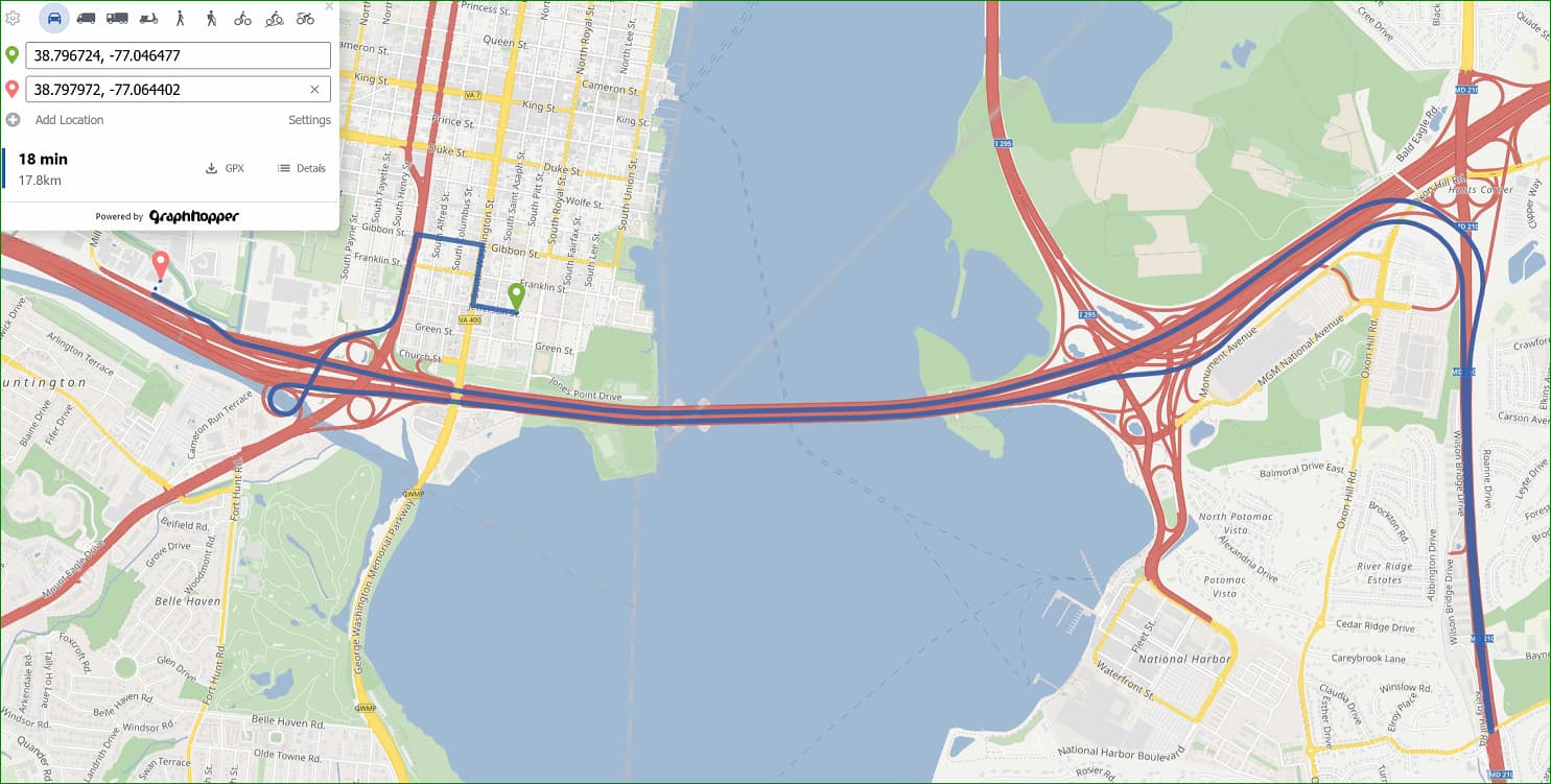
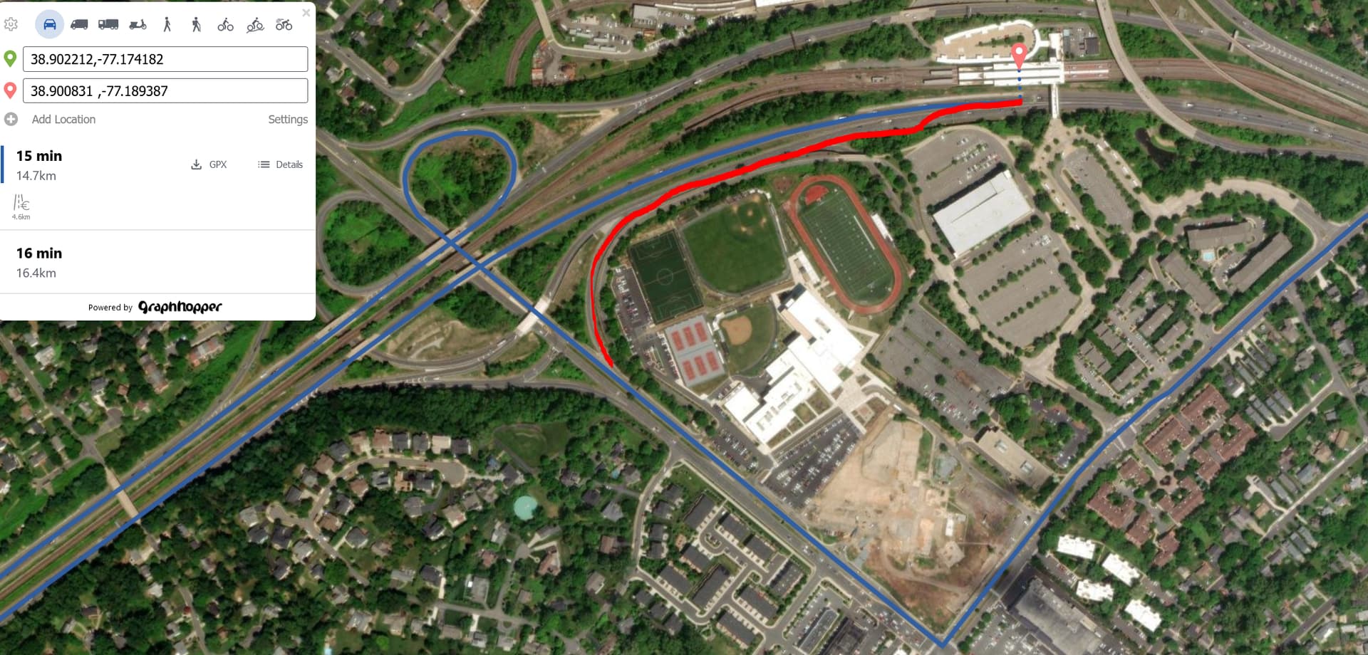
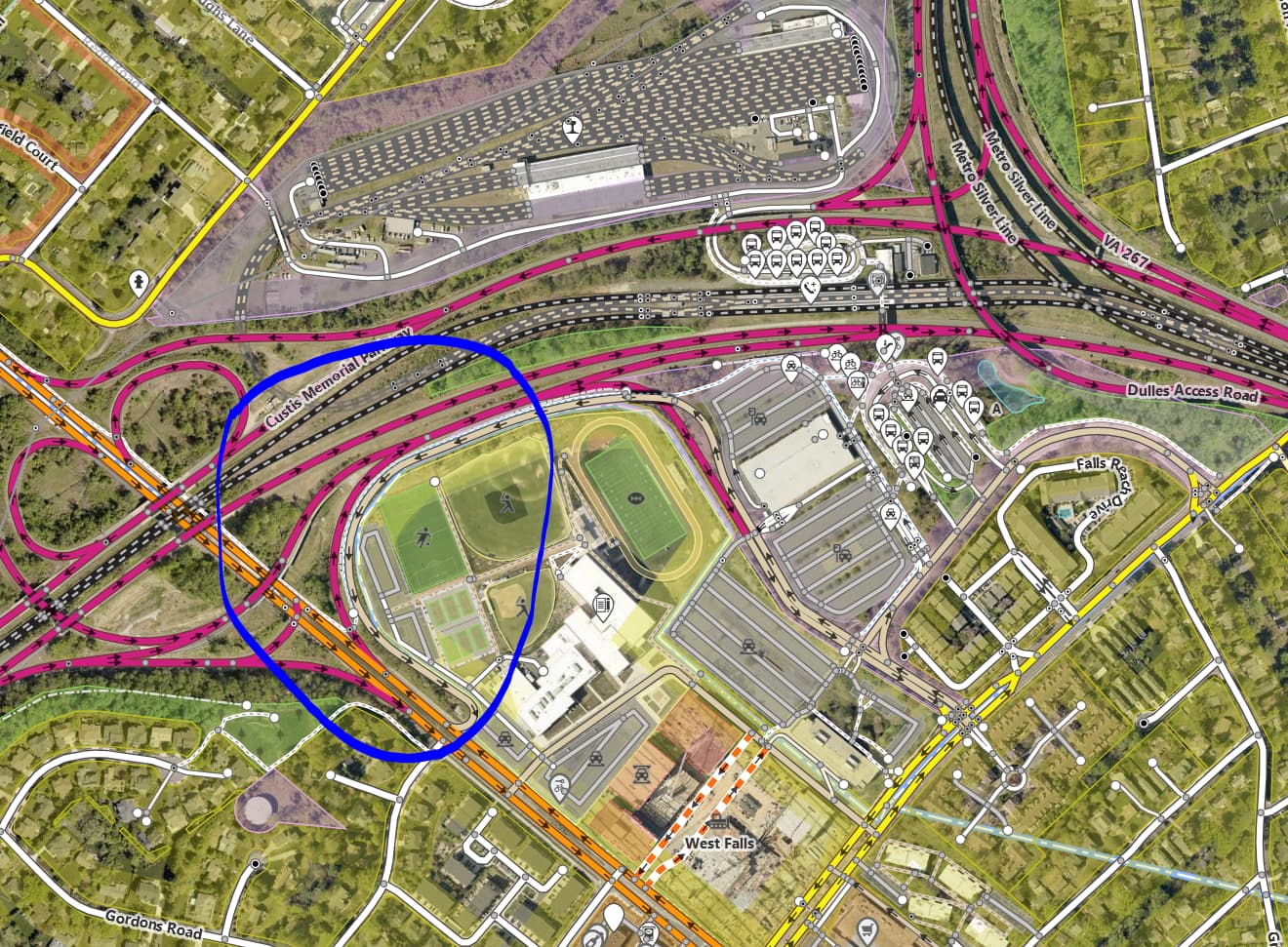
Any suggestion on how I should explain GraphHopper Maps | Route Planner? Looks like they are all residential houses with road connecting them, still GH chooses this route.
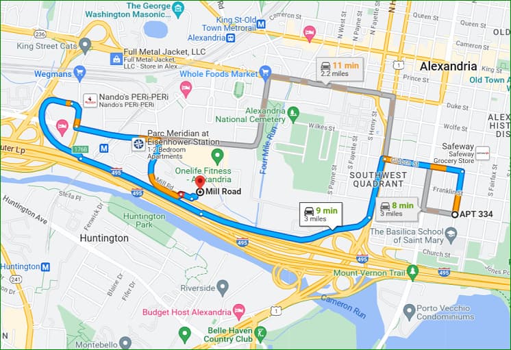
Thank you so much for the explanation. Could you look at GraphHopper Maps | Route Planner? GH takes the blue path. But, the red path is also accessible and faster.
Thank you so much.
Could you please share what are the usual things that GH avoids?
Some are: when it is a private road/gate, HOV lanes. What else?
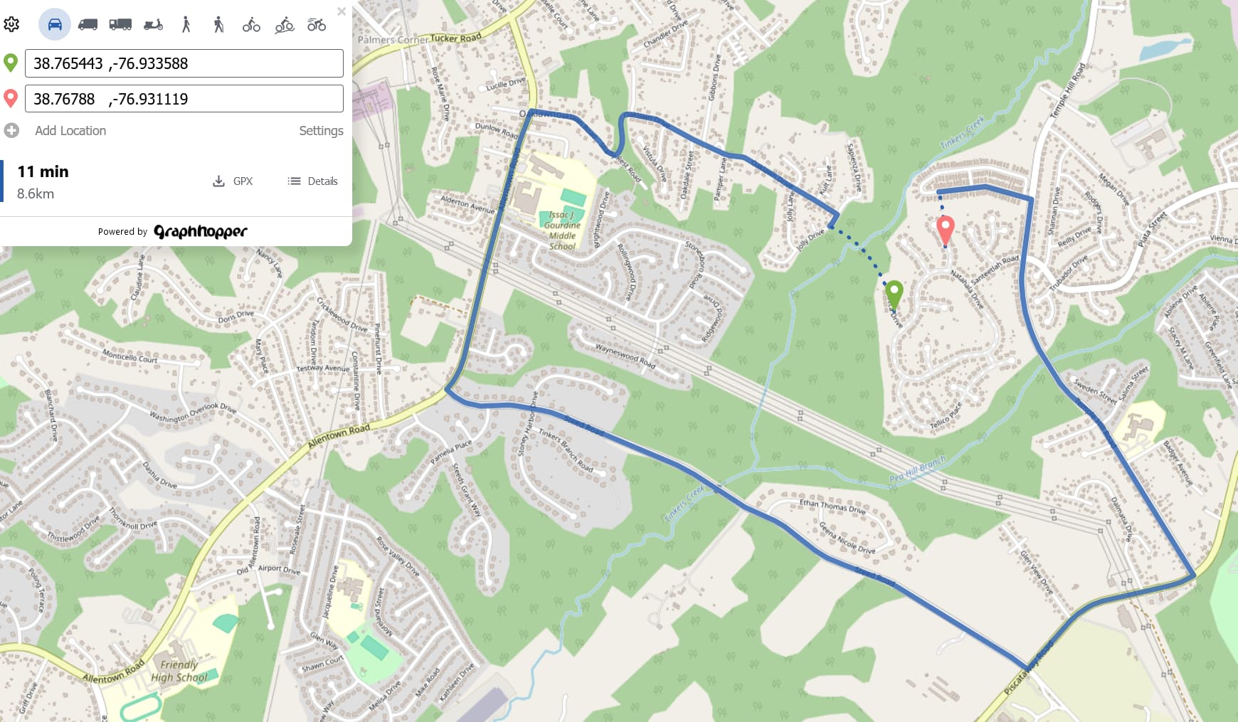
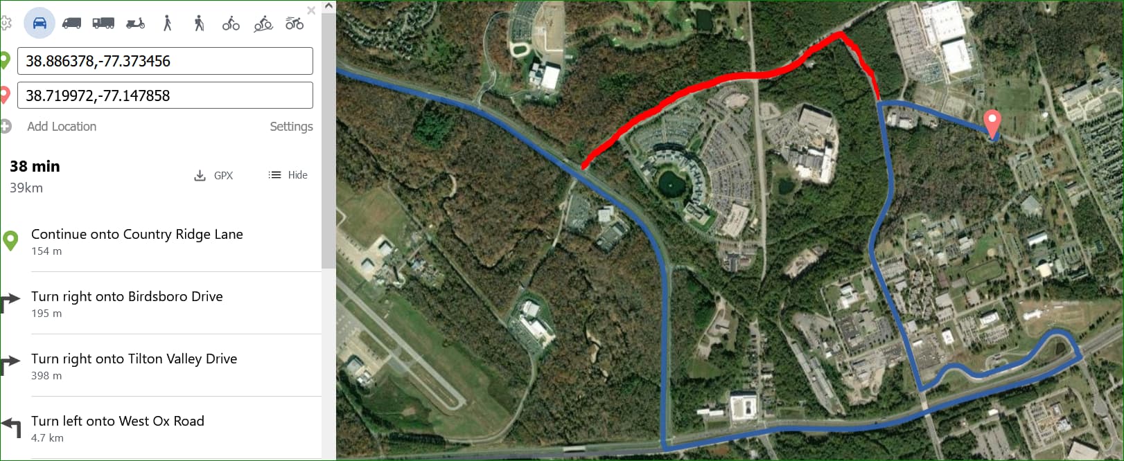
I used car as the only mode and found that GH did not use a pedestrian bridge over a road, rather took a long route to reach the dest by car. If, I could activate walk mode, would it be different and GH would take the bridge?
Also, I saw routes can be different and much faster in GH web version but much slower using source code. What is the reason for that?