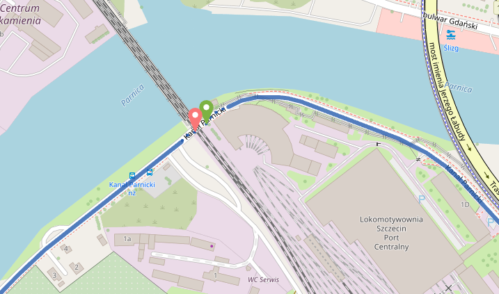
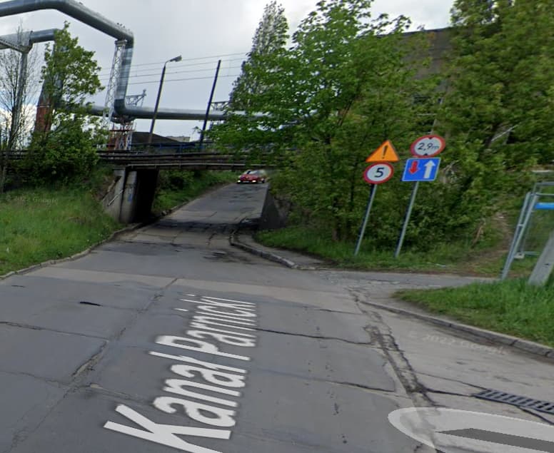
I have inspected the road in OpenStreetMaps, and it doesn’t have any restriction. The only thing is that it has max_speed 5 km/h. Any idea of what could be happening? For bikes, and foot work well…just failing for motorbikes and cars
Link to the road in Open Street Maps: Way: Kanał Parnicki (228884290) | OpenStreetMap
Maybe is related to the lanes? Because I see like there is capacity just for 1 vehicle at a time to pass the tunnel
Yes, if I swap the origin with the destination same result. It is like there was no edge in that section of the graph. I don’t see any height/width limitations
There were problems in earlier versions where a very low speed was set to 0 leading to blocking access. So you can try a later version where this should be fixed or debug the was in more detail and ensure that the speed is never 0. Or e.g. set the speed factor to 2 instead of the default 5.