Hello folks!
I am curious to know why GH is not finding the route when the destination is inside a specific cemetery location.
In the first example you can see like for walk profile, it is working properly.
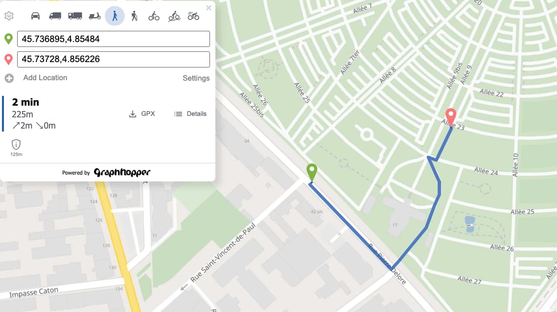
If you debug in the UI the road access, information. I don’t know why, GH interprets all the roads inside de cemetery are private, although if you inspect the OSM data, they have access=permissive.
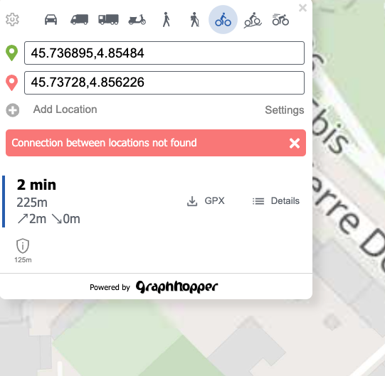
Then when you compute the same route but for bike profile, the engine is not able to find a route connecting the origin and destination.
I have the following questions:
- Why GH informs all the roads inside the cemetery as private?
- Why works walk profile?
- Why is not working bike profile?
Thanks a lot in advance