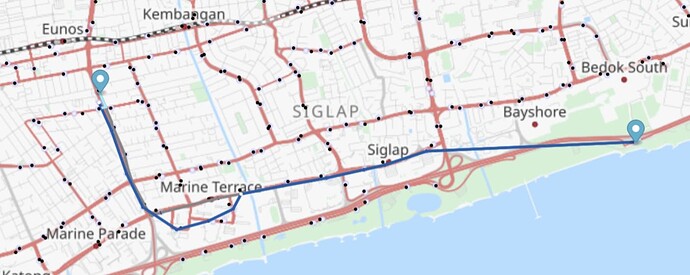
From my understanding, when we use the PT routing, the bus route Lat/Long is from the stops and not actually routing along the road. As a result, some route may show lines cutting through buildings and going off-road.
Now I see that regular routing gives you the ability to download a GPX file, which you could then use for map-matching. However, I don’t see the GPX option when looking at /maps/pt/ routing.
What are some other ways I can generate a coordinate list that would snap to the road?
EDIT: I tried calling the route url directly and added type=gpx
but got {"code":406,"message":"HTTP 406 Not Acceptable"}
