We are happy to announce more precise elevation data for our routing services!
Here is one of the many examples in the blog post:
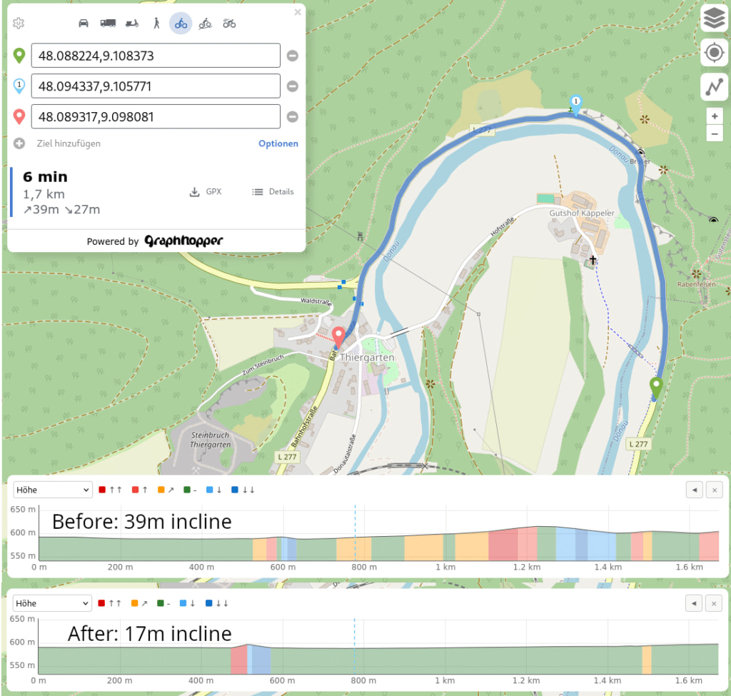
Happy elevation-aware routing and let us know if you have questions and feedback.
We are happy to announce more precise elevation data for our routing services!
Here is one of the many examples in the blog post:
Happy elevation-aware routing and let us know if you have questions and feedback.
Is this available or will be made available to self setup installs of graphhopper?
Yes, it was merged into master. In contrast to most other elevation modes you need to download the elevation data in advance. See https://github.com/graphhopper/graphhopper/pull/3287
In a future version it might download the portions via http range queries from a hosted pmtiles file, but wasn’t goal of this PR.
That would be a godsend for smaller PBF extracts.
It it already very easy to create small extracts. Here eg for Germany
pmtiles extract https://download.mapterhorn.com/planet.pmtiles de.pmtiles --bbox=5.8663,47.2701,15.0419,55.0584 --minzoom=11 --maxzoom=12
This is great news! Would you be able to tell us which data files from Mapterhorn and which zoom level are required to achieve the same results? From the PR I guess planet.pmtiles at zoom 11 or 12?
By the way, is it possible to support your open source work in any way? We are now using GraphHopper for gpx.studio and would like to start redirecting part of the donations we receive to our main dependencies.
Yes, zoom level 12 is required, but even at 11 it could already be an improvement.
is it possible to support your open source work in any way?
Sure, you can attribute us in your application and/or subscribe to e.g. a basic plan (for as long as you like) of our commercial API ![]()
Thank you for your answer!