I can successfully build 0.11-SHAPHOT version and run server. But results so far are a bit strange - for example, I have a river near starting point, and another coast should not be accessible by foot within distance limit - but it was marked as such and included in polygon.
Could you provide an actual example where this happened or at least a screenshot? I think this would help to understand the issue.
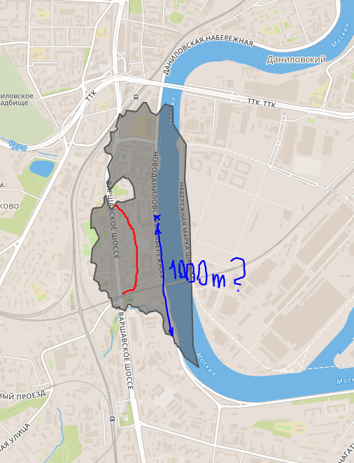
Starting point was around center of this screenshot. Distance was 1000 meters, so, I think that distance along the river left coast shoud be approximately 1000 meters also.
And only bridge awailable is railway, not accessible by foot.
I think that right coast shoud not be awailable at all.
Also, there is a fence, marked by red line, so street at left (north to south direction) is not available also. If i try to create a route from the same point to any point at this street, I can see that only two routes exists.
full graphhopper response:
iso.geojson (211.0 KB)