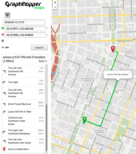
I followed the intructions as indicated in https://github.com/graphhopper/graphhopper/blob/master/reader-gtfs/README.md.
Downloaded .pbf and gtfs for Portland, OR (seems to be one of the most widely available), and ran these commands:
./graphhopper.sh buildweb

java -Xmx5g -Xms5g -jar web/target/graphhopper-web-*-with-dep.jar datareader.file=portland_oregon.osm.pbf gtfs.file=portland-gtfs.zip jetty.port=8989 jetty.resourcebase=./web/src/main/webapp graph.flag_encoders=pt prepare.ch.weightings=no graph.location=./graph-cache`
I then access localhost:8989 and when I input a local start and ending points, it shows
2018-02-12 17:22:19,898 [qtp525968792-34] ERROR com.graphhopper.http.GHBaseServlet - point=45.515971%2C-122.682266&point=45.521984%2C-122.678833&type=json&locale=en-US&vehicle=pt&weighting=fastest&elevation=false&key=&pt.earliest_departure_time=2018-02-12T22%3A11%3A00.000Z 0:0:0:0:0:0:0:1 en_US Mozilla/5.0 (X11; Linux x86_64) AppleWebKit/537.36 (KHTML, like Gecko) Ubuntu Chromium/49.0.2623.108 Chrome/49.0.2623.108 Safari/537.36 [45.515971,-122.682266, 45.521984,-122.678833], took:18.053343, , fastest, pt, errors:[java.lang.RuntimeException: No route found]
Am I doing something wrong?
Strange. I fetched this GTFS and for the PBF I used this and then I got a direct connection for your example using the same java commands:
But even if there is no connection you should get the walking instructions. Maybe you can retry with the files I linked? Did you wait until you saw GHServer - Started server at HTTP :8989?
I do get GHServer - Started server at HTTP :8989.
I’m able to open the UI, but when I try to input a start and an end, it says “no route found”.
I will try with the aforementioned GTFS and PBF and let you know.
Thanks!
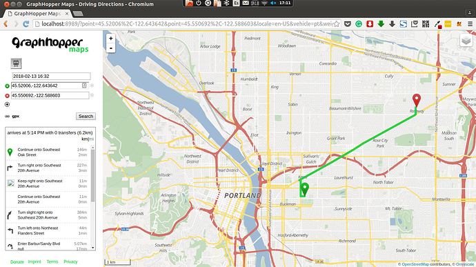
Ok, I was able to route with this data. But I only get car data. Here’s is a screenshot:
What should I do to get bus routes?
(Also, I’m unable to see the tiles if I’m not online. Is there a solution for that?)
Why do you think it is car data? It should be the bus (You can see the instruction “Enter Barbur/…”) where you walk to/from the station.
Oh, thanks, @karussell, I hadn’t realized. How can I get more detailed information (about the route name, for instance)?
Another thing, how can I make it work totally offline (tiles included)?
How can I get more detailed information (about the route name, for instance)?
The instruction should give this information. If not, then either the GTFS doesn’t have this info or there is a problem
The routing engine does not do this (except the MiniGraphUI from the tools module) you probably should look into openmaptiles.org

