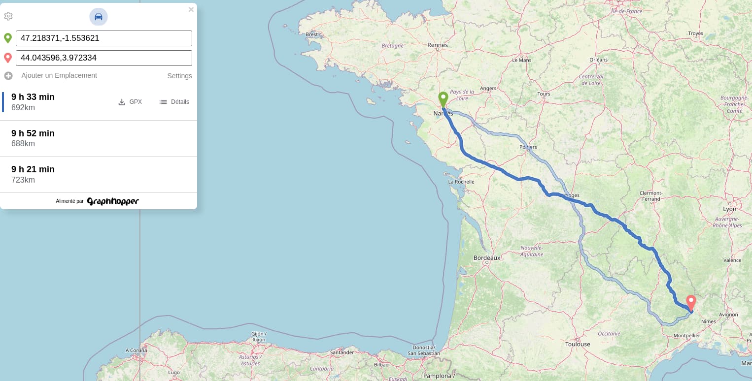
I didn’t spend a lot of time playing with it, but my use case involves computing long distance car routes in France, and I have a case that I would like to understand if I can improve.
I may have overlooked distance_influence: I thought the default profile was 100% time based, but it seems it’s not the case. I’ll give it a try with a profile with this setting to 0, and I’ll report back
We still use a slightly different car profile for our online services. But you can achieve the same also with the open source project. The biggest change requires to consider a speed limit inner city. For that you use the urban_density. (For backward compatibility we still use a proprietary mechanism for this “urban_density” mechanism and we cannot release this as open source - hence the differences.)
Hi, and thanks for the quick answer! I understand the online service has clever tricks, but in the end using distance_influence = 0 did a perfect job for me, so I’m quite happy with it for now.