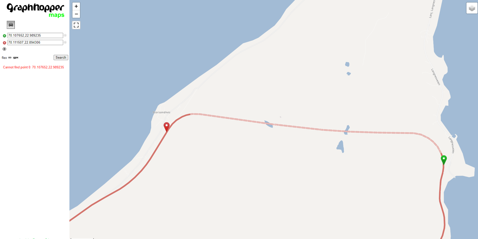
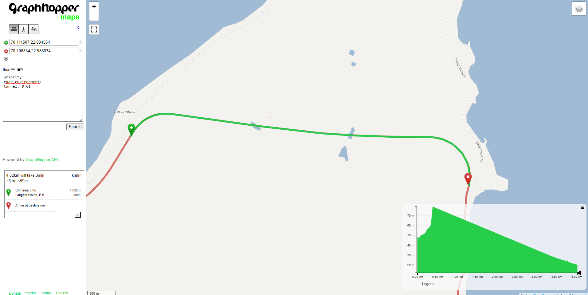
I’ve noticed that a route I generated on Norway was quite off and after some tries I’ve found that the the routing ignores some tunnels. https://graphhopper.com/maps and the route was ok but on local it just ignores it. I assumed I have something missing in the config file but I can’t find what I am missing.
Both the weighting and the profile are the same
Local:
GH Web:
my config.yml:
graphhopper:

  # OpenStreetMap input file PBF or XML, can be changed via command line -Ddw.graphhopper.datareader.file=some.pbf
  datareader.file: ""
  # Local folder used by graphhopper to store its data
  graph.location: graph-cache

  ##### Vehicles #####


  # More options: foot,hike,bike,bike2,mtb,racingbike,motorcycle,car4wd,wheelchair (comma separated)
  # bike2 takes elevation data into account (like up-hill is slower than down-hill) and requires enabling graph.elevation.provider below.
  #graph.flag_encoders: car


  # Enable turn restrictions for car or motorcycle.
  graph.flag_encoders: car

  # Add additional information to every edge. Used for path details (#1548), better instructions (#1844) and tunnel/bridge interpolation (#798).
  # Default values are: road_class,road_class_link,road_environment,max_speed,road_access (since #1805)
  # More are: surface,max_width,max_height,max_weight,max_axle_load,max_length,hazmat,hazmat_tunnel,hazmat_water,toll,track_type

  graph.encoded_values: surface,max_width,max_weight,max_height,hazmat,toll,track_type

  ##### Routing Profiles ####

  # Routing can be done for the following list of profiles. Note that it is required to specify all the profiles you
  # would like to use here. The fields of each profile are as follows:
  # - name (required): a unique string identifier for the profile
  # - vehicle (required): refers to the `graph.flag_encoders` used for this profile
  # - weighting (required): the weighting used for this profile, e.g. fastest,shortest or short_fastest
  # - turn_costs (true/false, default: false): whether or not turn restrictions should be applied for this profile.
  #   this will only work if the `graph.flag_encoders` for the given `vehicle` is configured with `|turn_costs=true`.
  #
  # Depending on the above fields there are other properties that can be used, e.g.
  # - distance_factor: 0.1 (can be used to fine tune the time/distance trade-off of short_fastest weighting)
  # - u_turn_costs: 60 (time-penalty for doing a u-turn in seconds (only possible when `turn_costs: true`)).
  #   Note that since the u-turn costs are given in seconds the weighting you use should also calculate the weight
  #   in seconds, so for example it does not work with shortest weighting.
  # - custom_model_file: when you specified "weighting: custom" you need to set a yaml file that defines the custom_model.
  #   If you want an empty model you can also set "custom_model_file: empty".
  #
  #   For more information about profiles and especially custom profiles have a look into the documentation
  #   at docs/core/profiles.md or the examples under web/src/test/resources/com/graphhopper/http/resources/ or
  #   the CustomWeighting class for the raw details.
  #
  # To prevent long running routing queries you should usually enable either speed or hybrid mode for all the given
  # profiles (see below). Otherwise you should at least limit the number of `routing.max_visited_nodes`.
  profiles:
- name: car
  vehicle: car
  weighting: fastest

  #  - name: car_with_turn_costs
  #    vehicle: car
  #    weighting: short_fastest
  #    distance_factor: 0.1
  #    turn_costs: true
  #    u_turn_costs: 60

  # Speed mode:
  # Its possible to speed up routing by doing a special graph preparation (Contraction Hierarchies, CH). This requires
  # more RAM/disk space for holding the prepared graph but also means less memory usage per request. Using the following
  # list you can define for which of the above routing profiles such preparation shall be performed. Note that to support
  # profiles with `turn_costs: true` a more elaborate preparation is required (longer preparation time and more memory
  # usage) and the routing will also be slower than with `turn_costs: false`.
  profiles_ch:
- profile: car
#- profile: car_with_turn_costs

  # Hybrid mode:
  # Similar to speed mode, the hybrid mode (Landmarks, LM) also speeds up routing by doing calculating auxiliary data
  # in advance. Its not as fast as speed mode, but more flexible.
  #
  # Advanced usage: It is possible to use the same preparation for multiple profiles which saves memory and preparation
  # time. To do this use e.g. `preparation_profile: my_other_profile` where `my_other_profile` is the name of another
  # profile for which an LM profile exists. Important: This only will give correct routing results if the weights
  # calculated for the profile are equal or larger (for every edge) than those calculated for the profile that was used
  # for the preparation (`my_other_profile`)
  profiles_lm: []

  ##### Elevation #####


  # To populate your graph with elevation data use SRTM, default is noop (no elevation). Read more about it in docs/core/elevation.md
  graph.elevation.provider: srtm


  # default location for cache is /tmp/srtm
  graph.elevation.cache_dir: ./srtmprovider/


  # If you have a slow disk or plenty of RAM change the default MMAP to:
  # graph.elevation.dataaccess: RAM_STORE


  #### Speed, hybrid and flexible mode ####


  # To make CH preparation faster for multiple profiles you can increase the default threads if you have enough RAM.
  # Change this setting only if you know what you are doing and if the default worked for you.
  # prepare.ch.threads: 1

  # To tune the performance vs. memory usage for the hybrid mode use
  # prepare.lm.landmarks: 16

  # Make landmark preparation parallel if you have enough RAM. Change this only if you know what you are doing and if
  # the default worked for you.
  # prepare.lm.threads: 1

  # In many cases the road network consists of independent components without any routes going in between. In
  # the most simple case you can imagine an island without a bridge or ferry connection. The following parameter
  # allows setting a minimum size (number of nodes) for such detached components. This can be used to reduce the number
  # of cases where a connection between locations might not be found.
  prepare.min_network_size: 600


  ##### Routing #####


  # You can define the maximum visited nodes when routing. This may result in not found connections if there is no
  # connection between two points within the given visited nodes. The default is Integer.MAX_VALUE. Useful for flexibility mode
  # routing.max_visited_nodes: 1000000


  # If enabled, allows a user to run flexibility requests even if speed mode is enabled. Every request then has to include a hint ch.disable=true.
  # Attention, non-CH route calculations take way more time and resources, compared to CH routing.
  # A possible attacker might exploit this to slow down your service. Only enable it if you need it and with routing.maxVisitedNodes
  routing.ch.disabling_allowed: true


  # If enabled, allows a user to run flexible mode requests even if the hybrid mode is enabled. Every such request then has to include a hint routing.lm.disable=true.
  # routing.lm.disabling_allowed: true

  # Control how many active landmarks are picked per default, this can improve query performance
  # routing.lm.active_landmarks: 4


  # You can limit the max distance between two consecutive waypoints of flexible routing requests to be less or equal
  # the given distance in meter. Default is set to 1000km.
  # routing.non_ch.max_waypoint_distance: 10000000


  ##### Storage #####


  # configure the memory access, use RAM_STORE for well equipped servers (default and recommended)
  graph.dataaccess: RAM_STORE


  # will write way names in the preferred language (language code as defined in ISO 639-1 or ISO 639-2):
  # datareader.preferred_language: en


  # Sort the graph after import to make requests roughly ~10% faster. Note that this requires significantly more RAM on import.
  # graph.do_sort: true


  ##### Spatial Rules #####
  # Spatial Rules require some configuration and only work with the DataFlagEncoder.


  # Spatial Rules require you to provide Polygons in which the rules are enforced
  # The line below contains the default location for the files which define these borders
  # spatial_rules.borders_directory: core/files/spatialrules

  # You can define the maximum BBox for which spatial rules are loaded.
  # You might want to do this if you are only importing a small area and don't need rules for other countries.
  # Having less rules, might result in a smaller graph. The line below contains the world-wide bounding box, uncomment and adapt to your need.
  # spatial_rules.max_bbox: -180,180,-90,90


# Uncomment the following to point /maps to the source directory in the filesystem instead of
# the Java resource path. Helpful for development of the web client.
# Assumes that the web module is the working directory.
#
assets:
  overrides:
/maps: web/target/classes/assets/

# Dropwizard server configuration
server:
  application_connectors:
  - type: http
port: 8989
# for security reasons bind to localhost
bind_host: localhost
  request_log:
  appenders: []
  admin_connectors:
  - type: http
port: 8990
bind_host: localhost
# See https://www.dropwizard.io/1.3.8/docs/manual/configuration.html#logging
logging:
  appenders:
  - type: file
time_zone: UTC
current_log_filename: logs/graphhopper.log
log_format: "%d{YYYY-MM-dd HH:mm:ss.SSS} [%thread] %-5level %logger{36} - %msg%n"
archive: true
archived_log_filename_pattern: ./logs/graphhopper-%d.log.gz
archived_file_count: 30
never_block: true
  - type: console
time_zone: UTC
log_format: "%d{YYYY-MM-dd HH:mm:ss.SSS} [%thread] %-5level %logger{36} - %msg%n"