According to the table on https://www.graphhopper.com/open-source/ the geocoding api should be available in the open source edition. However I am not able to use the api on our local install?
Regards
Jens
According to the table on https://www.graphhopper.com/open-source/ the geocoding api should be available in the open source edition. However I am not able to use the api on our local install?
Regards
Jens
Could you kindly direct me to this other project then?
Regards
Jens
It is https://github.com/komoot/photon or https://github.com/gisgraphy/gisgraphy/ or https://wiki.openstreetmap.org/wiki/Nominatim
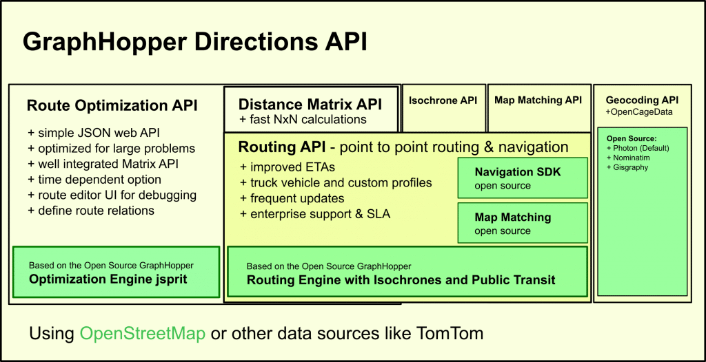
Why is it then shown as being part of the open source version of graphhopper. It specifically says the geocoding api is included in the open source. If they are just referring to external projects they could say that graphhopper includes many things…
Not sure what you mean. The table and the overview say what is open source and what is included in the GraphHopper Directions API. The table says nothing about the features of the open source routing engine and the overview shows clearly that the geocoding and route optimization are different blocks.
Ok. Thank you for your answers.