Hi,
one of our clients experienced a strange routing-result, where a specific shorter track isn’t used on the map.
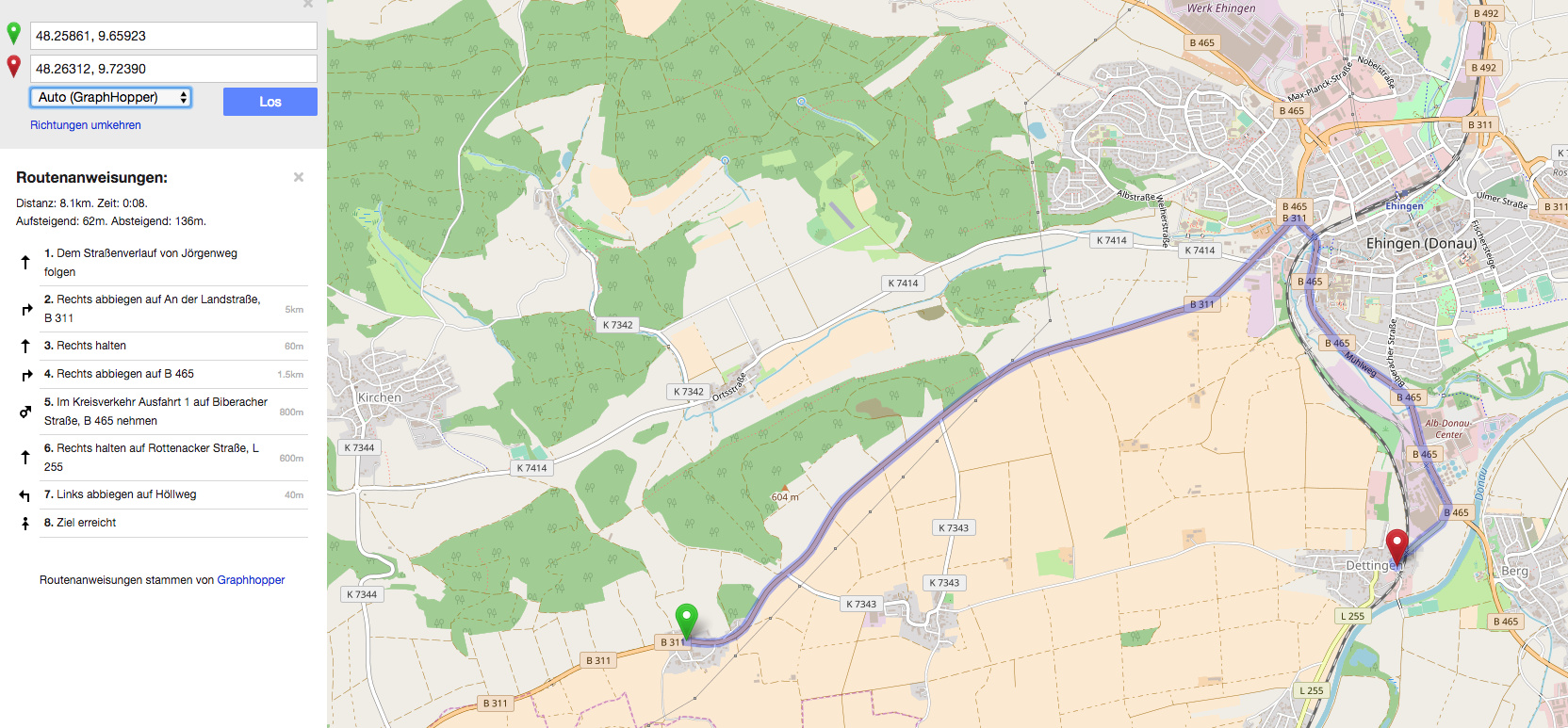
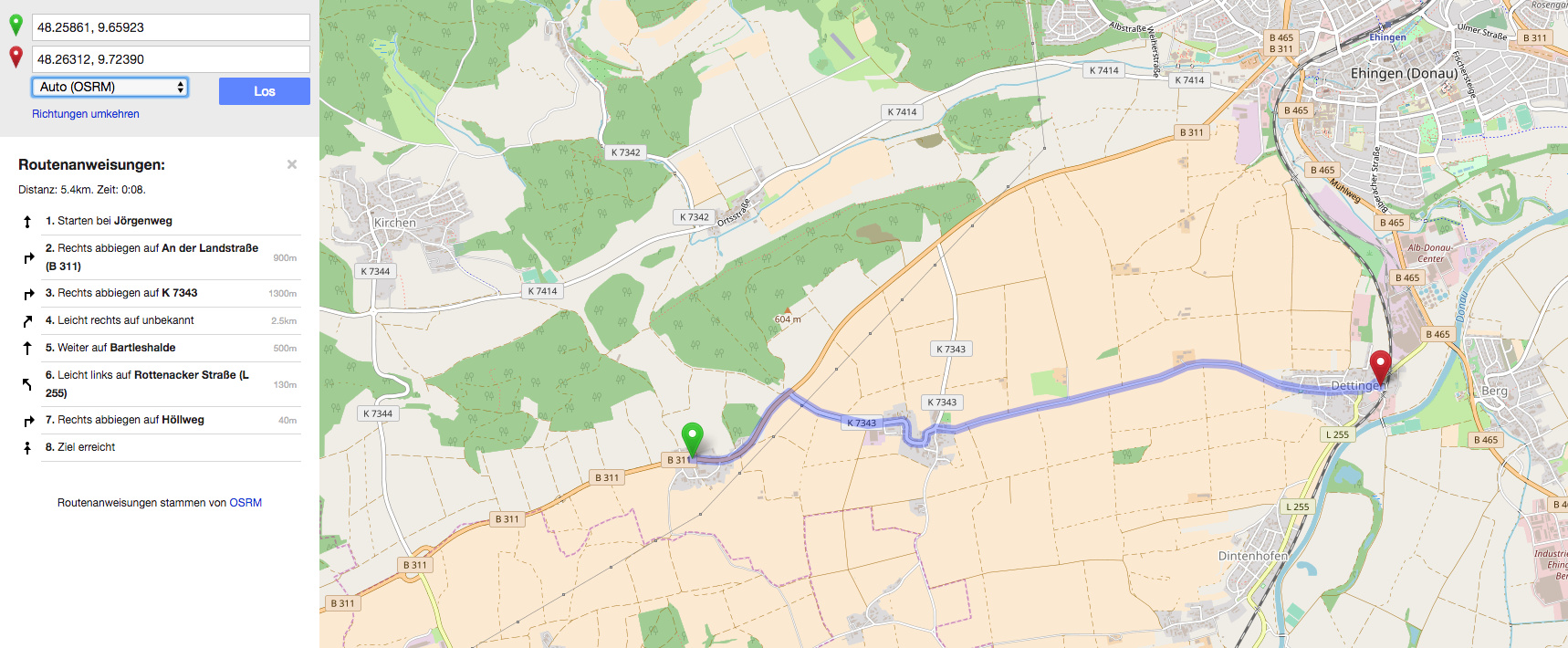
So we tried to reproduce it over the OSM website.
What we now noticed is, that the plain OSM website with OSMR does the route correctly. With the Graphhopper option set, OSM does not route correctly.
Here are two screens which shows the issue:
Well, ‘correctly’ means it uses a better time estimate? We do the estimation based on heuristics which can fail but are on average much better than e.g. OSRM.
On GraphHopper Maps you can enable some debugging options and you can see that we calculate an average speed of 20km/h for https://www.openstreetmap.org/way/280780562 where other routers says at least 50km/h.
We’ll have a look why there is such a difference.
Okay, but for the user’s eye the solution which’s using the longer route doesn’t make sense cause the estimated travel time is in both solutions 8 minutes.
 thank you for you help!
I have about the same problem.
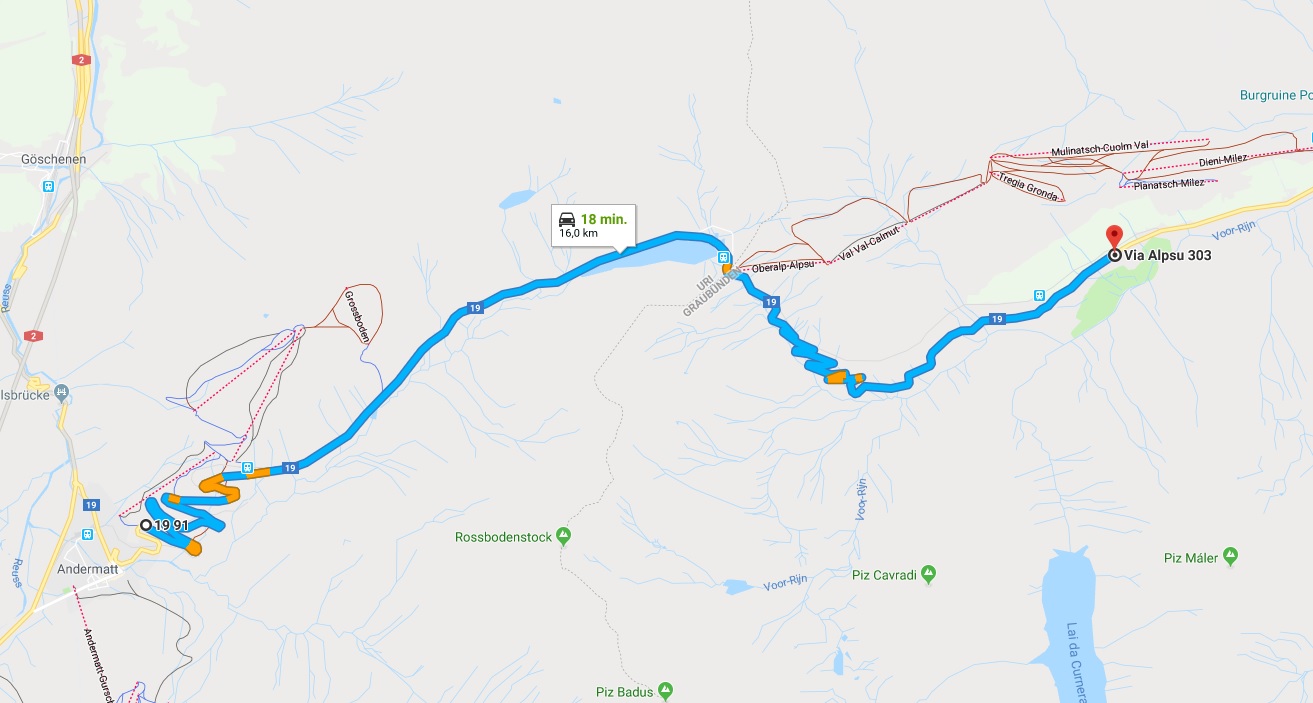
When i want to calculate a route from 46.63746,8.60062 to 46.66015,8.71820, which is the Oberalp pass in Switzerland, GraphHopper is coming up with a wrong result. Have a look at the first image.
I have added another image which offers the proper route (calculated using Google Maps).
Somewhere on the road there is a point that cannot be taken into account, when a route is calculated, and I don’t understand why.!
Is this a known problem? Is there anything I can do make GraphHopper to come up with the proper results? Or is it a GraphHopper problem?
And here is the other image, since I was allowed to add one image only to my first post…
It is not the same problem, please use different topics.
Do you mean that I have to remove my posts and start a new topic?
I am sorry, I am new here, but if that is what you mean, I will do it.
Please let me know.
No problem. Just start a new topic.
@LarsLehmann I have investigated this case a bit. And an unclassified road is a road like on this picture: Tag:highway=unclassified - OpenStreetMap Wiki and either the tagging is incorrect or the speed estimate of 50km/h is too high IMO on such a small road if you want to drive safe. We estimate it to 30km/h and due to some (not yet found) issue it is further reduced to 20km/h.