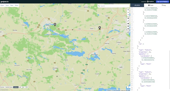
I am having an issue using the route web API. What I want is to get the shortest path between two points, so I use weighting = shortest. Another requirement is that my customers need to be able to close roads, meaning that they submit a coordinate, and I ensure that that coordinate is avoided. The way I have implemented this is by drawing a square around that point, and then mapping it to a custom model, where I set the priority to zero.
However, it seems that one of these two are not working (shortest weighting or closing a road). When I post the following json:
{
    "points": [
        [
            9.974817036680832,
            56.15063242652721
        ],
        [
            9.606132685260434,
            56.165955689633904
        ]
    ],
    "profile": "truck",
    "ch.disable": true,
    "debug": false,
    "calc_points": false,
    "instructions": false,
    "custom_model": {
        "areas": {
            "type": "FeatureCollection",
            "features": [
                {
                    "type": "Feature",
                    "properties": {},
                    "geometry": {
                        "type": "Polygon",
                        "coordinates": [
                            [
                                [
                                    9.754235338325909,
                                    56.15088662234999
                                ],
                                [
                                    9.747784661674093,
                                    56.15088662234999
                                ],
                                [
                                    9.747784661674093,
                                    56.147293377650016
                                ],
                                [
                                    9.754235338325909,
                                    56.147293377650016
                                ],
                                [
                                    9.754235338325909,
                                    56.15088662234999
                                ]
                            ]
                        ]
                    },
                    "id": "spaerring0"
                },
                {
                    "type": "Feature",
                    "properties": {},
                    "geometry": {
                        "type": "Polygon",
                        "coordinates": [
                            [
                                [
                                    9.619902611394895,
                                    55.93195337765002
                                ],
                                [
                                    9.626317388605106,
                                    55.93195337765002
                                ],
                                [
                                    9.626317388605106,
                                    55.93554662234999
                                ],
                                [
                                    9.619902611394895,
                                    55.93554662234999
                                ],
                                [
                                    9.619902611394895,
                                    55.93195337765002
                                ]
                            ]
                        ]
                    },
                    "id": "spaerring1"
                }
            ]
        },
        "priority": [
            {
                "if": "in_spaerring0",
                "multiply_by": "0"
            },
            {
                "if": "in_spaerring1",
                "multiply_by": "0"
            }
        ]
    },
    "weighting": "shortest"
}
I get this result back:
{
    "hints": {
        "visited_nodes.sum": 1080,
        "visited_nodes.average": 1080.0
    },
    "info": {
        "copyrights": [
            "GraphHopper",
            "OpenStreetMap contributors"
        ],
        "took": 3,
        "road_data_timestamp": "2024-09-21T17:00:00Z"
    },
    "paths": [
        {
            "distance": 24998.667,
            "weight": 1727.025036,
            "time": 1249956,
            "transfers": 0,
            "points_encoded": true,
            "points_encoded_multiplier": 100000.0,
            "snapped_waypoints": "w|uuIqe{{@q~A|~fA"
        }
    ]
}
But without the custom model I get this:
{
    "hints": {
        "visited_nodes.sum": 1080,
        "visited_nodes.average": 1080.0
    },
    "info": {
        "copyrights": [
            "GraphHopper",
            "OpenStreetMap contributors"
        ],
        "took": 4,
        "road_data_timestamp": "2024-09-21T17:00:00Z"
    },
    "paths": [
        {
            "distance": 24998.667,
            "weight": 1727.025036,
            "time": 1249956,
            "transfers": 0,
            "points_encoded": true,
            "points_encoded_multiplier": 100000.0,
            "snapped_waypoints": "w|uuIqe{{@q~A|~fA"
        }
    ]
}
Which has a higher distance. How can this be true when I use shortest as the weighting? Am I supposed to do something else to get the shortest weighting?
Below you will find my custom model and my points drawn in geojson.io.
