Hi everyone,
I am currently self-hosting GraphHopper locally and comparing my results against the official demo at graphhopper.com/maps.
When testing a short car route in Monte Carlo using identical start/end coordinates, I noticed noticeable differences in calculated distance, estimated duration, elevation details, and even the exact path chosen by the router.
Comparison of Results:
-
Image 1: Self-Hosted Instance
-
Distance: 761 m
-
Duration: 1 min
-
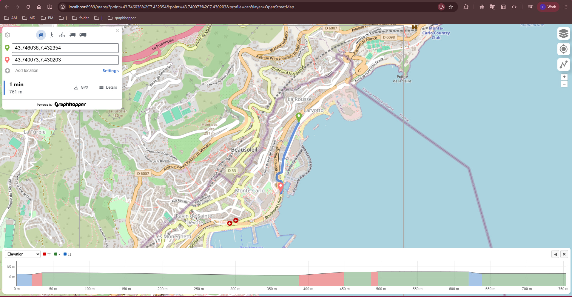
-
Image 2:
https://graphhopper.com/maps-
Distance: 799 m
-
Duration: 2 min
-
Route Geometry: Takes a slight loop/alternative maneuver at the roundabout/intersection.
-

My Questions:
I understand that GraphHopper relies heavily on config.yml, custom models, and elevation providers. I would love to know how to configure my local instance to match the behavior of the official web client:
-
Elevation Configuration: What
graph.elevation.provider(e.g., SRTM, CGIAR, GMTED) and settings are used on the official site? -
Profile & Routing Logic: Is the
carprofile ongraphhopper.comusing custom models (like turn costs, turn restrictions, or modified average speeds) that cause the 761 m vs. 799 m route difference? -
Data Source: Could differences in the OSM PBF extract date or bounding box account for the turn differences?
Any advice or example configurations to help mirror the official GraphHopper Maps setup locally would be greatly appreciated!