Hello guys,
I’ve been facing an issue with my graphhopper instance.
When I request a certain route, through graphhopper web, it gives me different options than my local graphhopper instance.
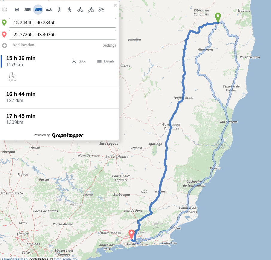
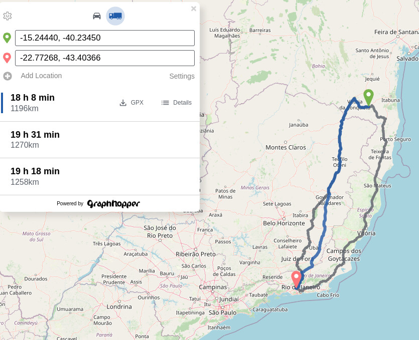
Graphhopper web:
Graphhopper Internal:
I’d like to know, why this is happening, and how can I troubleshoot it?
I have already checked the routing graph option, but I found no information that would help me in anyway.
Currently I’ve been using the latest planet osm release 240729, and I’ve been using the exactly same truck profile available in graphhopper repository on github.
We are using a slightly different profile. Read here more about it. Also it is unclear what configuration you are using.
Hey @karussell ,
I just read the topic you have mentioned. Just to be sure, when you say, slightly different profile, you mean, the configuration used in graphhopper web, has little differences from the truck profile available in graphhopper github repository, correct?
Now, about my current configuration, I have the following:
config.yml:
    graphhopper:
      datareader.file: ""

      custom_models.directory: /graphhopper/profiles

      profiles:
        - name: car
          vehicle: car
          custom_model:
            distance_influence: 70
        - name: truck
          vehicle: roads
          weighting: custom
          custom_model_files: [ truck.json ]
      profiles_ch:
        - profile: car
        - profile: truck
      profiles_lm: []

      prepare.min_network_size: 1000
      prepare.subnetworks.threads: 1

      routing.non_ch.max_waypoint_distance: 100000000 #100.000.000
      routing.max_visited_nodes: 10000000 #10.000.000

      import.osm.ignored_highways: footway,cycleway,path,pedestrian,steps # typically useful for motorized-only routing

      graph.location: graph-cache
      graph.dataaccess.default_type: RAM_STORE
      graph.encoded_values: hgv,max_weight,max_height,max_width,toll
      graph.vehicles: roads|hgv=true

    server:
      application_connectors:
      - type: http
        port: 8989
        bind_host: localhost
        max_request_header_size: 50k
      request_log:
          appenders: []
      admin_connectors:
      - type: http
        port: 8990
        bind_host: localhost

    logging:
      appenders:
        - type: file
          time_zone: UTC
          current_log_filename: logs/graphhopper.log
          log_format: "%d{yyyy-MM-dd HH:mm:ss.SSS} [%thread] %-5level %logger{36} - %msg%n"
          archive: true
          archived_log_filename_pattern: ./logs/graphhopper-%d.log.gz
          archived_file_count: 30
          never_block: true
        - type: console
          time_zone: UTC
          log_format: "%d{yyyy-MM-dd HH:mm:ss.SSS} [%thread] %-5level %logger{36} - %msg%n"
      loggers:
        "com.graphhopper.osm_warnings":
          level: DEBUG
          additive: false
          appenders:
            - type: file
              currentLogFilename: logs/osm_warnings.log
              archive: false
              logFormat: '[%level] %msg%n'
truck.json:
{
  "distance_influence": 1,
  "priority": [
    { "if": "road_access == PRIVATE",  "multiply_by": "0" },
    { "if": "car_access == false || hgv == NO || max_width < 3 || max_height < 4", "multiply_by": "0" }
  ],
  "speed": [
    { "if": "true", "limit_to": "car_average_speed * 0.9" },
    { "if": "true", "limit_to": "95" }
  ]
}
Do you have any idea, how can I achieve the needed result in my route?
At least you’ll need to implement the urban_density feature: Add urban density encoded value to identify built-up areas by easbar · Pull Request #2637 · graphhopper/graphhopper · GitHub
and set different estimated speeds based on rural or city. Also we have turn restrictions enabled in the config and use the latest GraphHopper from master branch.