Hi! In my case, I am pretty sure the profile didn’t change. Below I describe the exact setup I am using if it helps. Let me know if you need anything else.
OSM File
https://download.geofabrik.de/europe/great-britain-latest.osm.pbf
config.yml
graphhopper:
  datareader.file: ""
  graph.location: ""
  graph.elevation.provider: "srtm"
  prepare.min_network_size: 700
  prepare.min_one_way_network_size: 700
  routing.non_ch.max_waypoint_distance: 1000000
  graph.bytes_for_flags: 8
  graph.dataaccess: "RAM_STORE"
  graph.encoded_values: "max_height,max_weight,max_width,hazmat,toll,surface,track_type"
  graph.flag_encoders: motorcycle|turn_costs=true

  profiles_ch:
    - profile: custom_motorbike

  profiles:
    - name: custom_motorbike
      vehicle: motorcycle
      turn_costs: true
      u_turn_costs: 0
      weighting: custom
      custom_model_file: custom_motorbike.json
custom_motorbike.json
{
  "speed": [
    {
      "if": "road_class == MOTORWAY",
      "limit_to": 60
    },
    {
      "if": "road_class == MOTORWAY && road_class_link",
      "limit_to": 60
    },
    {
      "if": "road_class == TRUNK",
      "limit_to": 60
    },
    {
      "if": "road_class == TRUNK && road_class_link",
      "limit_to": 60
    },
    {
      "if": "road_class == PRIMARY",
      "limit_to": 23
    },
    {
      "if": "road_class == LIVING_STREET",
      "limit_to": 5
    },
    {
      "else": null,
      "limit_to": 15
    }
  ],
  "priority": [
    {
      "if": "toll == HGV || toll == ALL",
      "multiply_by": 0.0
    },
    {
      "if": "road_environment == FERRY",
      "multiply_by": 0.0
    }
  ],
  "distance_influence": 1200
}
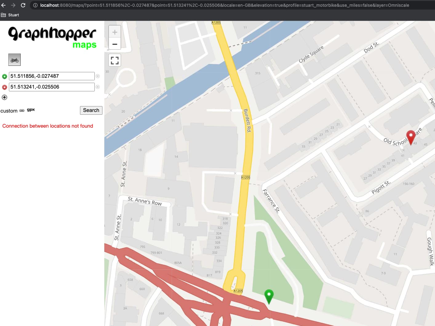
The routes failing are:
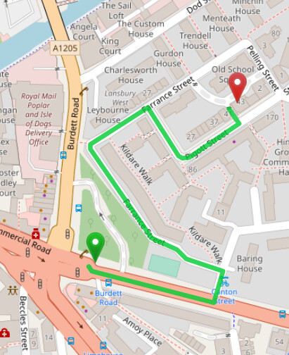
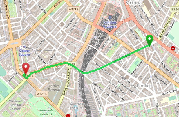
Example 1 (origin, destination): 51.49224,-0.13922. ------------- > 51.489871,-0.156003
Example 2 (origin, destination): 51.51185608,-0.0274867 ------> 51.513241,-0.025506