Route within parking aisle

Hello,

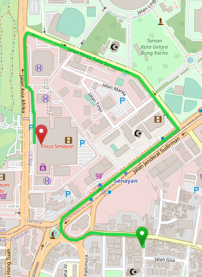
I’m experimenting Graphhopper in my local computer using OSM Public PBF file and default configuration. I noticed that when trying this particular O-D in Graphhopper public API Driving Directions - GraphHopper Maps the route result is correct.

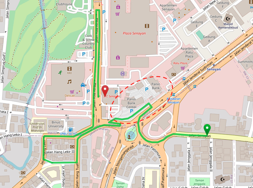
However when I tried in my local computer the route result is taking unnecessary shortcut in this building’s parking aisle -6.228413878293068,106.79951727390291 why I said that it’s an “unnecessary” because it’s very unusual for driver to take that shortcut since they have to pay for the parking fee to enter and then exit the parking aisle. I’m using the default config and jar file available in the github repo during my experimentation.

Could anyone help me is there any different config(weighting?) that is being used by the Graphhopper Public API or there should be OSM tags that I must aware of?

Thank you
Regards

Naul

I tried with indonesia-latest.osm.pbf from Geofabrik and I get the same routing result locally as on GH Maps:

Can you send a screenshot of the route that you think is not correct?

Hi @easbar

Apologies for incorrectly put the link there the correct one should be this example Driving Directions - GraphHopper Maps
After further investigation, I just realised that I made a small edits for this OSM way Way: ‪Jalan Pattimura‬ (‪449551341‬) | OpenStreetMap so that it can’t make left turn to Way: ‪Jalan Sisingamangaraja‬ (‪449551322‬) | OpenStreetMap and the editing was done in my local OSM setup then I exported it to the OSM PBF to be consumed by graphhopper.

I attached the screenshot that the route is taking parking-aisle area (red-circle) as a shortcut.

Thank you

This topic was automatically closed 90 days after the last reply. New replies are no longer allowed.