I wanted to use the graphhopper library to my project so i’ve tested the navigation with the web-version of graphhopper.
But it offers a completely wrong route calculation for my case:
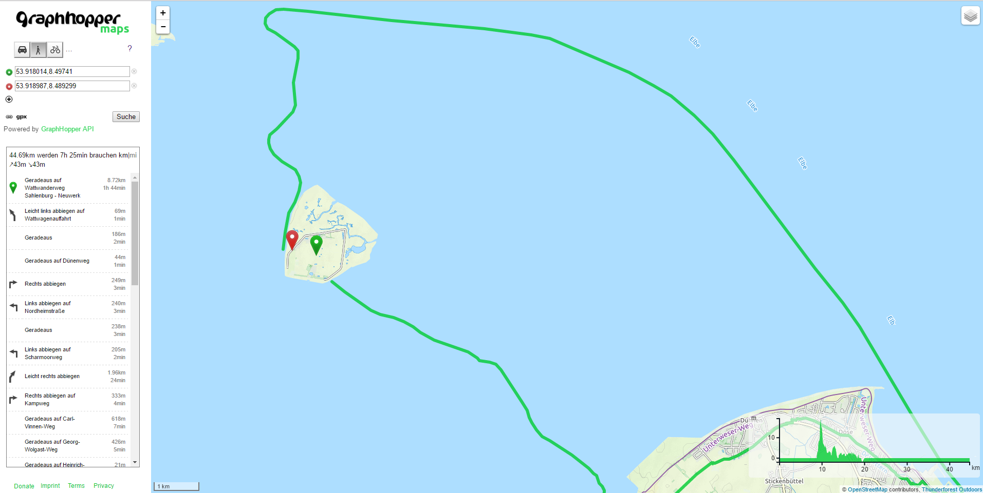
What went wrong there?
Thanks 
I wanted to use the graphhopper library to my project so i’ve tested the navigation with the web-version of graphhopper.
But it offers a completely wrong route calculation for my case:
What went wrong there?
Thanks
Can you give me the URL for this case? And is your intend to use our hosted version or your own servers?
I’m not sure yet what version i will use
but how to solve the problem?
You go to openstreetmap.org and connect the ways appropriately: e.g. http://www.openstreetmap.org/node/3287468787 and http://www.openstreetmap.org/node/762549406
The problem is not that the island is not connected to the mainland, the problem is that all navigation on the island isn’t working at all. GraphHopper can’t find any (correct) route between the two markers (they could also be placed anywhere else on the island)
If there are too small islands completely disconnected from the mainland we remove the network there as often those areas are problems. Also in this case the island is not properly connected and if you connect it like suggested plus on the northern side (the other ferry) then it will work properly.
hey,
I have connected the two points now. So how much time will it take until Graphhoppers navigation service will work?
It takes roughly 2-3 days.
great. It works now. Thanks! 
Buongiorno, segnalo questa situazione, il calcolo del percorso non permette l’attraversamento dei guadi.
https://graphhopper.com/maps/?point=46.580029%2C12.00619&point=46.582403%2C12.00664&locale=it-IT&vehicle=hike&weighting=fastest&elevation=true&use_miles=false&layer=TF%20Cycle
Grazie e complimenti per il lavoro